
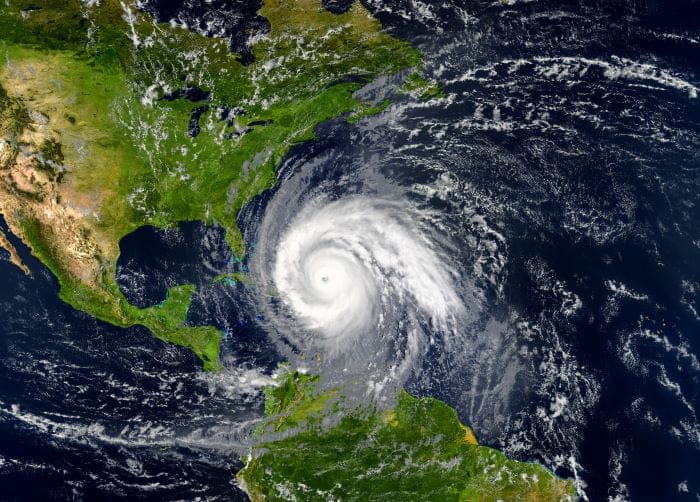
Hurricane Myths Busted: The Truth Behind Common Hurricane Misconceptions
Is wind more dangerous than water?
Will Tampa always dodge big storms?
Will taping your windows prevent them from breaking?
Hurricane season is here, and while it’s important to know the facts and be prepared, it’s also easy to become misinformed.
We recently spoke to ABC Action News Chief Meteorologist Denis Phillips about some of the most common hurricane myths. He gave us his take on why they’re not true, what you should really know about hurricanes, and how to be prepared.

Myth: Wind is the most dangerous part of the hurricane.
Denis Phillips: That's false. The most damaging and the most impactful part of the storm would be storm surge. If you live inland, out of the flood zone, then wind is going to be the biggest issue for you. But if you live along the coast, water is the biggest issue.
We’ve seen the horror stories of storm surge. Typically, storm surge is in a small area, and usually, the worst of it by far is only a couple of hundred yards from the coast in a very small area – typically in the northeast quadrant of that storm.
Myth: Flooding can only occur if you live along the coast.
Denis Phillips: That's absolutely not true. Storm surge and flooding are two very different things. When we talk about flooding with hurricanes, we talk about inland freshwater floods. And that's rainfall.
Think about it this way: When a storm is coming towards us and it's pushing all this water into our area from the Gulf, when we get all this rain, that rain has to drain somewhere through the rivers, through the creeks, into the Bay, into the Gulf. And that's how the water recedes.
But when the water is being pushed in as the storm approaches, there's no place for that water to go because it's being pushed literally back inland. So, all that rainfall has no place to go and will lead to a lot of inland flooding. Almost all of that is just freshwater rainwater flooding.
Storm surge flooding is more devastating to areas along the immediate coastline because not only do you have the rise of water, but you also have the waves on top of that rise of water so you can get a 10-to-12-foot storm surge and then throw in another 20 to 25 feet of waves on top of that rising water as it comes in. That's where you get a lot of structural damage.
Myth: If you live outside the cone, you’re safe from damaging effects.
Denis Phillips: Here’s something that most people don't know. The cone has nothing to do with the forecast track of that storm. The cone is nothing more than a statistical presentation of what storms with that track have done that far out over the last 30 years. The cone takes wherever that track is at the center point, and then takes out statistically 75 miles in either direction from the last 24 hours.
Well, the center line is really the only thing that's coming from the Hurricane Center. The cone isn't really an accurate representation of that storm. It's just an accurate representation of what storms have done at a certain period on a similar track.
Whatever the margin of error is over the last 30 years, that is what the cone is.
Myth: You don’t need to evacuate unless you know for certain where the storm will make landfall.
Denis Phillips: We’ve seen it all happen repeatedly where we're in a cone and the storm misses us or it turns. Unfortunately, there's a sense of apathy that comes along with it.
I’ve noticed with a big storm, people have a tendency to take it more seriously. They will be far more likely to evacuate earlier. Then if it's maybe a cat 1 or a cat 2 and they're like, ‘Well, you know what? That's not horrible. I can ride it out. I can go without power for a day or two.’
And if it’s a 1 or 2, you're right, you can. The problem is, what if that 1 or 2 gets stronger and before landfall, becomes a 4?
And honestly, that's the worst-case scenario for us folks in Florida. At some point, we're going to have a storm because the water is so warm and the warmer the water, the more likely it is for rapid intensification. So, people are going to go to bed and it's a 1 and they're like, ‘Well, we're going to be OK.’ And they wake up and it's a 4.
And at that point, it's too late to go anywhere because the traffic's too bad or they can't get out or whatever the case may be. They're going to ride it out. I just think it's up to people's own personal plan of attack and what they're going to do and how they're going to handle it.
Myth: Tampa always dodges the storms, so we’ll be OK again this year.
Denis Phillips: Knock on wood, it is absolutely fair to say Tampa is not in a hurricane prone area for major hurricanes. You can't argue with the fact that it's been 103 years since we have seen a major hurricane. That’s not luck and that's probably not the Indian burial ground either.
I think most people blow it off because that center of the line goes directly into Tampa, and I think we all know storms coming in from the West side have a tendency to curve at the very end.
At the end of the day, a cat 1 or tropical storm passes within 50 miles of the bay area every four years—that’s the statistic. So, we often see storms passing to our west at a 1 or lower and usually they're going to the Panhandle.
There's a reason for that because hurricanes travel towards the poles, they're designed to do that. So, a storm coming in from the South is going to go far. More likely it's going to go into the Panhandle than it is in our area.
The only thing that's going to kick a storm into our area coming in from the South is a cold front or a trough of low pressure. How many cold fronts and troughs with low pressure do we get in July and August and early September? Not too many.
So, these storms that form in the Caribbean, and there'll probably be quite a few this year with the La Nina, they're going to come in from the south and they're going to want to go north. And if they do, they're going to go to the Panhandle or they're going to go to Louisiana.
Now, I think we all know at some point we are going to get a major hurricane. We are. I mean, there is no way around it. It's going to happen. Whether it happens sooner or later, who knows.
Myth: Tropical storms won’t be destructive and don’t need as much storm prep as a hurricane.
Denis Phillips: The water is higher than it was 30 years ago, and our water rise is more pronounced. So, areas that typically would not flood in the past in a tropical storm are now flooding.
There's also been some bad luck that some of these storms have hit at king tides when the tide has been super high for the month anyway. You have a king tide every year or every month. It's just the highest tide of the month, and it's predictable. We've had a couple of storms at king tide, which has made it worse.
But on the other side of the coin, we are seeing water rise and the more water rising we see, the more likely it is that areas that never used to flood in tropical storms will flood now.
Myth: Taping your windows will protect them and you should also crack them to stabilize the pressure.
Denis Phillips: Taping the windows has absolutely nothing to do whatsoever with protecting your home, and neither does opening a window.
Typically, that was something people used to do for tornadoes, thinking that that would equalize the pressure. And it has absolutely no impact. But people still do it. Neither will be opening up your windows. It'll just get everything inside wet even if the storm doesn't really hit that hard.
Myth: Hurricanes can only occur between June 1 and Nov. 30.
Denis Phillips: Nope. As a matter of fact, five of the last six years, we've had a named storm in May. Now, there's some people out there trying to expand the hurricane season to May. Along the Pacific Ocean, their hurricane season does start in May. Our starts June 1.
In my mind, does it really matter if something's technically hurricane season or not? If there's a storm out there, we're going to track it. I don't care if it's in the season or not. I don't really think it matters.
But, early season storms, ones in May and June, typically aren't really big wind makers. They're usually more rain makers. And quite often, an early season tropical storm has been a blessing for parts of our area. Typically in March, April, and May, we're so dry that when you get a tropical storm come in in June and give us 10-15 inches of rain, it pretty much busts the drought.
Myth: If we have more named storms, that indicates that there's going to be a more dangerous season.
Denis Phillips: Statistically speaking, it's just not the case for all our area. If you go back and look at history, a very active year or a very inactive year does not change the risk of us being hit directly by a hurricane. The numbers just don't show that.
Now the East Coast, the Outer Banks of the Carolinas, the Panhandle, and the northern Gulf Coast – those areas do have a higher likelihood of landfall if it's a more active season. People will say, ‘Well, that's common sense. If there's more storms, there's going to be a higher risk of us getting hit.’
I get the logic, but the numbers don't pan out.
What can we expect this hurricane season (2024)?
The predictions for this year are some of the highest they've ever been in history. And pretty much all the predictions are because the ocean is super warm in the Atlantic and we have a La Nina coming. But just because we have those two things doesn't mean that there aren't other factors that go in the other direction, one of which is Saharan dust from Africa.
Typically, when you have a lot of Saharan dust coming off the coast of Africa, which we do regularly in June and July, that kind of squashes the development of the season.
I do think it's fair to say that there's going to be a pretty high number of named storms. However, that does not necessarily mean that they're going to be making landfall at certain places. And they can all be out in the middle of the ocean.
Ones coming from the south are always our biggest concerns. And last year, we didn't have any of those because we had an El Nino. But this year we have a La Nina and it's far more likely for these storms to develop.
Because of that, I do think we're going to have a lot of stuff coming in from the south now, which means we're probably going to have a lot of near misses or storms that come pretty close to us. It's just a question of whether they continue to go north in the Panhandle or northern Gulf Coast or move our way.
Related Stories:
- ABC Action News Meteorologist Denis Phillips Talks Hurricane Prep
- How to create a hurricane kit and find out if you live in an evacuation zone
You can follow Denis’s forecasts on Facebook @DenisPhillipsWeatherman and on Instagram @denisphillipsabcweather.
Feature Image credit: Mike Mareen | Originally published in the June 2024 issue of Tampa Bay Parenting Magazine.