
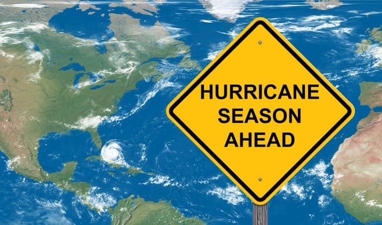
Hurricane Season 2023: What to Know and How to Prepare
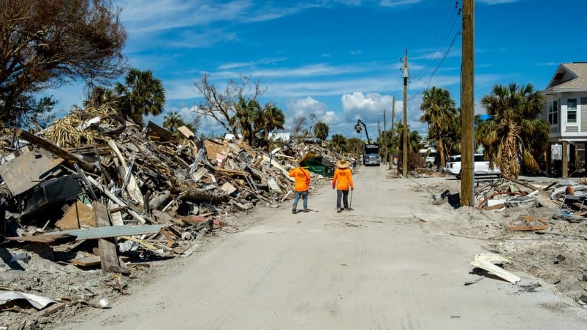
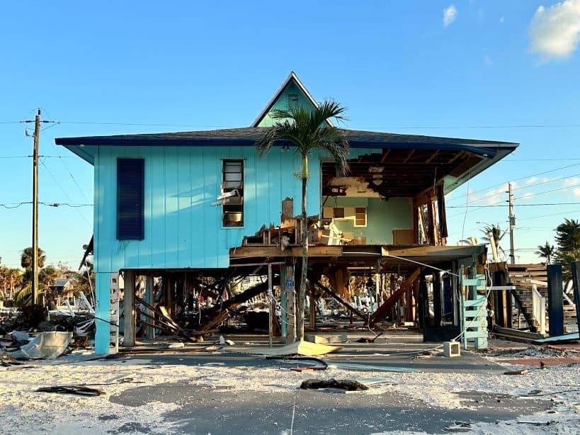
Although Tampa was lucky enough to narrowly miss Hurricane Ian’s path last year, we mourned with our neighbors to the south as we witnessed how catastrophically it hit them.
With hurricane season in full swing, the threat of potential storms is scary. Social media and TV graphics can be overwhelming. Though Tampa hasn’t had a major hurricane hit in 102 years, that’s not to say it won’t happen again. We spoke to Chief Meteorologist for ABC Action News, Denis Phillips, who explained what we should be looking at, what the spaghetti models mean, and why it’s important to pay close attention to local versus national news during a hurricane threat.
TBPM: People can get overwhelmed by the cone and overall visual area of the storm. What exactly should we be focusing on?
DP: People are going to look in the middle. You realize that the areas to the right or the left of the center are lower. Odds are they are. We know that the middle is where the center is, so that's probably where it's going to go.
I do think the important message is … when you have a storm coming in from the east coast, it's not going to give us a water issue. Usually, it's just going to be more of a wind issue, and by the time it goes across the state, it's going to be a lot. So, an east coast storm is never really a storm that we're going to be nearly as concerned about as we would be with one coming in from the south or the west.
The problem with the track coming in from the south is it requires a pretty sharp turn for it to come into our area. But the problem is—just a little subtle change in track when it's down around Cuba ends up being a 300- or 400-mile difference by the time it gets into the north.
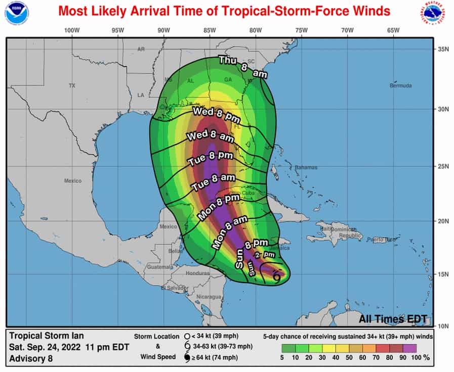
Now we knew about 36 hours out that Ian was going to stay South of Tampa. That, of course, is a real challenge because the Hurricane Center still has a line right on top of us. So how do you go on TV and tell people now? It's probably going to be well to our south when the official track is right on top of us. And the reason that's the case is that the Hurricane Center does not make drastic changes to their forecast. They don't like to do it, and with good reason, because one model might say, oh, it's going to go away this way.
The other ones completely change. It's called the windshield wiper effect, and what often happens is the models will go back and forth, back and forth until they finally reach the middle. Which is usually more accurate, but they can't go back and forth on their forecast because it's impossible for people to adjust when it's that back and forth, and then they just believe it anyway. So, 36 hours ahead, they were trending South of the Bay Area and we were pretty confident it was going to be to Fort Myers. And that's kind of an example of when you might want to tune in to your local meteorologist, one that you trust, who will probably be more forthright with you than a forecast from the Hurricane Center. It usually takes a little bit longer to make an adjustment.
TBPM: There are so many different models to look at when tracking a hurricane and the “spaghetti model” images can get confusing. What’s the best one to follow?
DP: The problem with models is they're just mathematical formulas. That's all they are. Sometimes the models get on runs like you do at the craps tables in Vegas and you just keep winning over and over again because, for whatever reason, it's really seeing the atmosphere very clearly. At that point, it's like when you're playing baseball and you're on a hot streak. The ball looks like a beach ball. That you just can't miss it. There are other times when you're in a slump and no matter what you do, you're not going to get it right. And the problem nowadays is there's so much information out there on social media that for the average person, it's going to be confusing because there's just too much.
I rarely tell people to look at models and try to determine where a storm's going to go because the models do drastically change so quickly. Again, it's just one of those times that I really think to pick a source, a single source. One that you trust, and go with that source, because otherwise you'll drive yourself crazy. The Hurricane Center are the official forecast tracks for any of these storms and they're always a good place to start. But what I tell people is if you want to kind of read inside of what that track is. Then you follow or watch your local meteorologist, one that you trust, as opposed to one that's more on a national scale.
The majority of the time, when the Hurricane Center is putting a forecast together … what they'll do is use what they call a blend of those two models, and that pretty much just means they average the two out and wherever the middle is, is what they go with. As it gets closer, at that point, you're using more accurate information; you're using more science-driven data.
TBPM: How can we help ease the minds of newcomers to Florida or friends and family who are out of state?
DP: We know that during hurricane season, The Weather Channel and other national media sources say, ‘You better run’ and friends and family up north are calling and asking why you haven't evacuated. At the end of the day, the local channels and the local meteorologists know the geography. They know the sub climates; they know the little things that happen in their local area. And The Weather Channel just can't know that because they don't know the little subtleties of those areas. So, you have got to tell your family and your friends up north to follow whoever it is that you follow on a local scale, and that honestly is the way to keep your sanity.
And at the end of the day, the majority of the time the national channels push the worst-case scenario and the majority of the time, the worst-case scenario does not happen. Occasionally it does. But I think my problem with that is if you constantly scare people over and over again, it won't take and it doesn't happen, it won't take long for people to lose their trust in that source. And to me, that's exactly what happened with national channels in terms of forecasting it and they're awesome in sending people out and showing what's happening in the storm and giving an overall view, but I see it on national media.
Catch Denis weekdays on WFTS-ABC Action News and follow him on Facebook for up-to-date weather info.
TBPM: Is 2023 predicted to be an active season?
DP: There are so many pieces of the puzzle on how hurricane season is going to play out. El Nino is an event with Pacific water. It gets unusually warm and when it does, it causes the ingredients that make our hurricane season traditionally quieter in terms of overall development, it usually cuts off the Caribbean. Usually, there's far too much wind for a tropical system to develop in the Caribbean. During an El Nino, usually the seasons are a little more active, either in the Gulf or near the Bahamas or out in the tropical Atlantic. But when that happens, the majority of the time, these would have a tendency to curve more away from the gulf and more toward the East Coast. That's what normally happens in an El Nino. But we always say it and I know it's overkill and I know people get sick of hearing it, but it's just the truth. It only takes one.
We’re supposed to have fewer storms this year compared to previous years because we will be in El Nino at least by late summer and into the fall. And that tends to minimize the number of storms. But I would still argue that yes, there might be fewer, but that doesn't mean they're not going to be every bit as strong as they would be otherwise. And that's obviously what our concern is.
TBPM: Why do you think that Tampa has gotten lucky and dodged the past few major storms at the last minute?
DP: Some people think it's the Indian burial grounds and some people think it's Saint Nicholas. The folks in Tarpon Springs pray to Saint Nicholas to keep them safe at the end of the day. I'll say something that probably sounds a little odd, but I truly believe it. First of all, yes, we are going to get another major hurricane. There's no way around it. We are absolutely going to get another one. It's been 102 years since the last major hurricane hit the Bay Area, and that's the one that took Hog Island and cut it in half, and we now have Honeymoon Island and Caladesi. So that shows you just how strong these storms actually are.
But you really can make the argument that the Bay Area directly is not necessarily a hurricane-prone area. Hurricanes are driven forward toward the poles, so a storm that's coming in from that exact area wants to go into the Panhandle, which, by the way, is why the Panhandle gets way more storms than we do. So, what would cause the storm to make a right turn and go into the West Coast of Florida? It's going to be a front, a cold front. How many cold fronts do we get in June, July, August, or September? We don't. So, the last major hurricane to hit our area was October 20th, 1921. And that was when a cold front came down. The reason that it's so difficult is because there has to be either a tropical pressure or a front coming down at the exact time as a storm that's coming in from the South and push it in such a way that it's going to drive it right into Central Florida.
Now the fact that we've missed the last three, that is luck. That is flat-out luck because it did turn. We knew it was going to turn, but the question is, does it turn in the Big Bend area? Does it turn in the Tampa Bay area? Does it turn in Southwest Florida? We in the last 20 years have been fortunate in our area. Any given year, you can't say that we're not in a hurricane prone area for a major hurricane, because at some point it is going to happen. We have to be prepared and when you see that cone of uncertainty on the West Coast of Florida, try not to focus on that center line as hard as it is, it really could be any place within that that cone.
Hurricane Preparedness 101
As we get ready for the 2023 hurricane season, it’s important to understand all elements of storm safety to make sure that you and your family are ready in case a major hurricane threatens our area. Hillsborough and Pinellas counties both have extensive guides and resources to help residents prepare.
Pinellas County recently released its “Ready Set Protect 2023 Hurricane Guide,” which provides resources such as evacuation information, hurricane prep and emergency supply lists. Residents can download the guide at pinellas.gov/hurricane-guide.
Hillsborough County residents are encouraged to go to hillsboroughcounty.org for preparedness tips, zone information and checklists.
Plan Ahead:
Even if there are no potential storm threats on the horizon, we all know too well that can change within a few days. Planning ahead of time will alleviate not only stress but also supply shortage. Putting together a hurricane kit early on in storm season is highly recommended. Pinellas and Hillsborough Counties both have checklists for emergency supplies and what you should have on hand, whether you’re staying at home or evacuating. You should also familiarize yourself with the nearest emergency shelter (if evacuated), know what your home needs in order to be structurally prepared, and understand what to expect after the storm.
Watch vs. Warning:
A hurricane watch happens 48 hours ahead of the onset of the tropical-storm-force winds (39-73 mph). A hurricane warning occurs 36 hours ahead of the onset of tropical storm-force winds (74 mph or more). Both watches and warnings need to be taken seriously and preparations to shelter in place or evacuate should be established at that time. Once winds reach a certain strength, emergency services will recommend sheltering in place, regardless of your zone, so it’s best to evacuate ASAP.
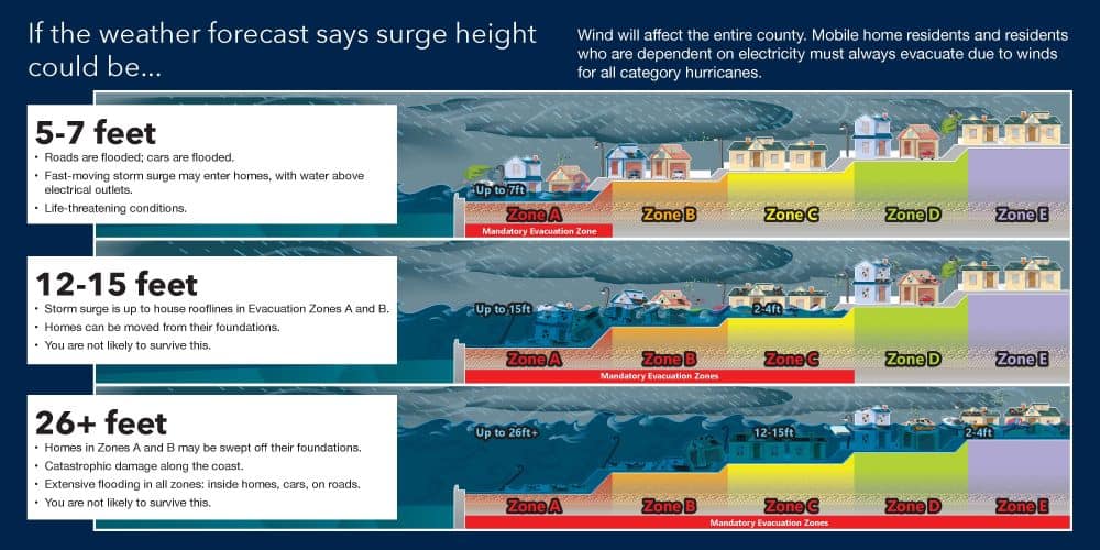
Know Your Zone:
One major cause of confusion is evacuation zone versus flood zone.
Evacuation zones are areas that officials may order evacuated during a hurricane. These zones are mapped out by the National Hurricane Center indicating areas that will be affected by storm surge. Flood zones are federally identified zones that indicate a property’s risk of flooding at any time of year – not just during hurricane season.
In 2022, Pinellas County updated its evacuation zones based on the latest data and storm surge models. Residents are encouraged to visit Pinellas.gov/emergency-information to learn which zone they’re in. Hillsborough County residents can go to hillsboroughcounty.org for more information on their zones.
After the Storm:
Residents should prepare not only for an impending storm but for post-storm effects as well. The most common after-effects include power outages, water contamination, sewer outages, and phone, cable and cell service outages.
Stay in the loop:
Familiarize yourself ahead of time and sign up for emergency alerts to stay informed and prepared.
Hillsborough County: hillsboroughcounty.org
Safety Info: hillsboroughcounty.org/en/residents/stay-safe
Emergency alerts: HCFL Alert – Hillsborough County’s mass notification system
Pinellas County: disaster.pinellas.gov
Emergency alerts: pinellas.gov/alert-pinellas
Pinellas County residents can also download the Ready Pinellas Emergency Planning Mobile app for free from the Apple App Store or Google Play store at pinellas.gov/ready-pinellas.
Pasco County: pascocountyfl.net/335/Hurricane-Preparedness
Emergency alerts: egov.pascocountyfl.net/AlertPasco
Related: How to create a hurricane kit and find out if you live in an evacuation zone