
Forecast Changes, AI Models and More. What to Know About Hurricane Season 2026 with Tampa Bay 28’s Denis Phillips
Hurricane season begins on June 1 and ends on Nov. 30, which means it's time to start prepping for any possible storms that may head our way this year.
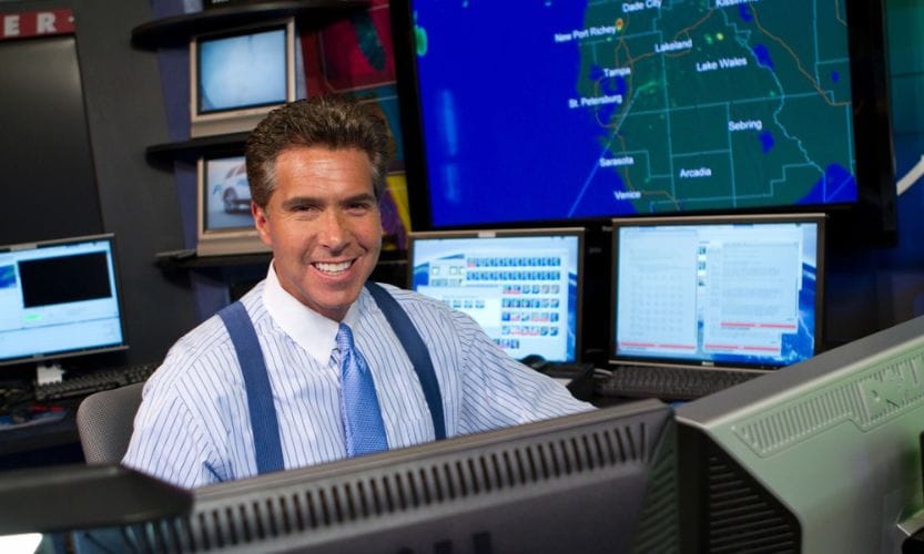
Lucky for us, last year’s hurricane season went easy on the Tampa Bay area after the devastating impacts of Hurricanes Helene and Milton in 2024. This year, hurricane predictions might look a little different due to some changes in forecast maps made by the National Hurricane Center. We spoke to Tampa Bay 28’s Chief Meteorologist, Denis Phillips, about the impacts of these changes and the benefits of AI models.
The National Hurricane Center recently came out with new forecast cone changes and changes in the hurricane prediction maps. Can you tell us more about that?
Dennis Phillips: The main differences are that they are now focusing on inland areas as opposed to just the coast. Like when you would get a hurricane or tropical storm warning, most of the impacts would usually be along the coastal areas, specifically storm surge. But they've obviously realized that storms that cut across the state can have a really large impact. Maybe not so much the surge, but flooding and certainly wind across the inland areas.
So now the new cones and the new watch and warning tracks will include inland areas for those warnings as well, to try to specify what areas inland will get in addition to the coastal areas.
What causes evacuation zones to change?
Dennis Phillips: Evacuation zones change year to year. That is completely dependent on what the emergency management folks in a particular county decide to do. People might say, and this is a valid argument, “How the heck is my flood zone changing so dramatically when nothing else has really changed?” It's a valid question. The problem isn't that the weather has changed or that the threat of a hurricane has changed. The problem is that our population has changed.
And because there are now so many more people in areas that didn't use to be in certain areas, EOC's responsibility in getting them out safely is changing. And they might very well decide that one area would be safer to stay put than to get on the roads with a million other people and cause even bigger problems.
So, it isn't always about the threat of a storm or landfall when the evacuation zones change or the flood zones change. It often has more to do with the population and dynamics of that area, as opposed to who will flood and who won't.
How active is the 2026 hurricane season expected to be?
Dennis Phillips: I've never been a fan of long-range hurricane forecasts. I think they're a waste of time. And I think they somewhat can be misleading in a lot of ways in the sense that, let's say, the predicted number of storms is below average, which is what it's going to be this year.
But you've heard it once — you've heard it a thousand times. It doesn't matter where, or it doesn't matter how many storms form. It just matters if they impact you directly. And when they say there's a slower-than-average season, there probably will be for several reasons. But it only takes one. Think back in the early ‘90s, back in 1992, we only had six named storms that year, and the first one wasn't until the middle of August. So … it was a very slow year. But if you ask people in South Florida if ‘92 was a slow year, they'd probably argue with you — because that was the year they had Hurricane Andrew.
I've done a lot of research on this. There's absolutely nothing to show that the odds of us being impacted one way or another by a hurricane, whether it's an active or inactive season.
On the west coast of Florida, if you go back in history, there's absolutely no relationship between the actual number of named storms that form and the impacts on our area. A lot of times, we have had our direct impacts when it has been a below-average season because Gulf storms form differently than storms out in the tropical Atlantic. The Gulf water has a huge, huge part of that.
Related: How Hurricanes Affect Mental Health and 10 Ways to Help Your Kids
What could impact this year’s storms?
Dennis Phillips: The people who are predicting it will be a quieter-than-normal year are pointing to an El Niño …. historically, an El Niño does mean we see fewer overall named storms. Other variables that come into play are the Saharan Desert and the dust that comes off Africa. That can have an impact.
A lot of other things come into play. But overall, the numbers are expected to be a little bit below average, and the average is about 15. But if we get 12 or 13, that doesn't mean we can't have a direct hit with a Cat 3 or Cat 4 in our area.
What are your thoughts on the AI-driven forecast models?
Dennis Phillips: The whole premise of an AI model is one that I agree with wholeheartedly. People used to make long-range forecasts during hurricane season based on what they called analogs. They would look at what they thought the overall setup of a weather pattern in the summer would be, and then they would go back and look at years when there were similar patterns. They would look and see how many hurricanes formed and where they formed but it wasn't amazingly accurate.
But that's honestly how the long-range forecast started going. They started using analogs and comparing the past to the present and coming up with a forecast. That's really all that the AI models do.
The Google Deep Earth model and the European AI model were both exceptional last year in forecasting some of the best models on earth. What they do is they take their regular forecast-driven model data that would go out a couple of weeks or so. And then they take it, and they put every bit of data in the computer that they've had over the last 75 years. They put in the current situation, and maybe what the forecast is for the next few weeks, and that computer goes in and tries to find another time in history, where it was very similar to what it is now, and comes up with a forecast. And it’s amazingly accurate.
It makes sense to me because if the atmosphere is chaotic, it's always changing. The last couple of years, with the AI data and the AI mapping, it has been amazingly accurate, really, helpful in forecasting.
Can you explain the difference between hurricane hunters and storm chasers?
Dennis Phillips: The hurricane hunters are through NOAA, through the Air Force. Those are the official hurricane hunters. They fly out of Lakeland, and they fly out of several spots in the country and use government and military planes to fly into the storm to get data that is gathered and then fed into the models.
So, for all the hurricane models that we use, the majority of that data comes from the hurricane hunters. They'll fly in, they'll gather data, and that data then goes into the models, and we come up with a forecast. That's what the official hurricane hunters do.
Storm chasers are entirely different. They are people who do it on their own, like the movie “Twisters.” They have people who run tours that go out and do them because they love it. They'll use their social media to do it and then go live and do a live broadcast, and sometimes make money off it.
But the ones that the government and the military run are the ones that are used for the data in the models. The other ones are in it for the actual thrill and excitement.
You can catch Denis’s forecasts on Tampa Bay 28 and at facebook.com/denisphillipsweatherman.
Related:
- Ask the Doctor: How to Help Your Child Mentally Prepare for Hurricane Season
How Hurricanes Affect Mental Health and 10 Ways to Help Your Kids
Originally published in the June 2026 issue of Tampa Bay Parenting Magazine